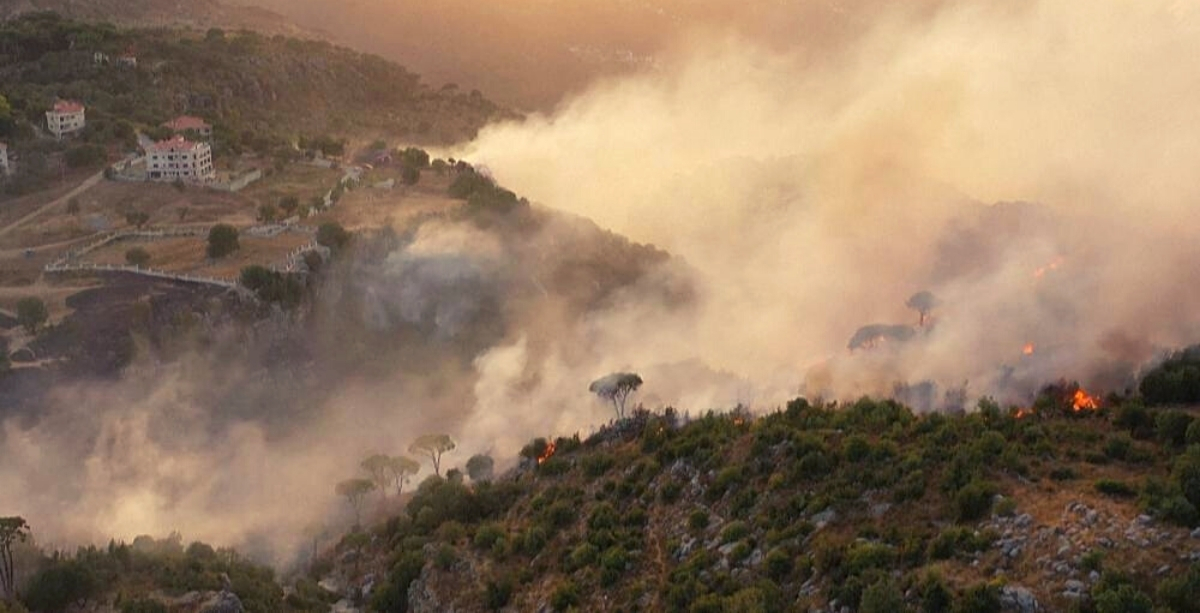
The heatwave that invaded Lebanon this week has set ablaze many areas, eating through massive forests and agricultural lands. Two maps released by the Internal Security Forces (ISF) show a large number of areas at high risk of fires starting.
Friday, October 9th was a day of smoke, fire, and panic; the same scenes that dominated October 13, 2019, when numerous fires broke out in different regions, injuring people and decimating vast areas of greenery.
And while the intensity of the heat seems to have somewhat dropped on Saturday compared to Friday, fires are still raging across Lebanon now for more than 35 hours in Akkar and other regions, and more are anticipated this weekend.
According to a statement by the ISF, the excessive rise in temperatures is likely to spark fires in various regions across Lebanon.
The color-coded maps that accompanied the warning showed the estimated risk levels in each region, for Saturday (right) and Sunday (left), with the color dark red denoting a “very high possibility of the occurrence and spread of fires.”
Judging by the maps, numerous areas from north to south are highly prone to fires breaking out on both days.
The threat level appears to be much higher in the western parts of the country, though moderate to high-risk indicators are also scattered in Beqaa and Baalbek-Hermel, with the latter having endured a wildfire just 4 months ago.
As a precautionary measure, the ISF calls on citizens not to start any fires for whatever reason, and to immediately inform Civil Defense in the event of spotting a fire, however small.
In the meantime, additional measures will be taken by municipal police and Civil Defense in the fire-prone regions, including organizing patrols to monitor forests and keeping firefighters and equipment on standby in high-risk areas.
